Death Valley Days
"Not for the faint of heart...a land of superlatives. It's name is synonymous with all that is harsh, hot and hellish..., it is also where nature is putting on a truly spectacular show."

 We set off from San Diego around mid-morning ..arriving before dinner hour at Death Valley which is located just east of the Sierra Nevada between the Great Basin and Mojave deserts. It is the hottest, driest and lowest place in North America! Thank goodness we are here in January folks ;)
 Furnace Creek Inn..talk about an oasis in the desert situated between the arid Amargosa & Panamint Mtn Ranges


 First day - to get our bearings and plan excursions we oriented ourselves at the Visitor Centre which showed today's temp to be 73F - this must be one of the coolest readings. The record temperature was set back in 1913 of 134F. Nearly 550 square miles of Death Valley National Park lie below sea level. Death Valley was named by gold-seekers, some of whom died crossing the valley during the 1849 California gold rush. We found out that the lookout at Zabriskie Point was undergoing renovations, thus our first plan re destinations to hit up was foiled :( ..no matter, we will travel up alternate peaks

 on our way to Badwater Basin ..not a soul nor car nor motorcyle in sight ..here's a possible roadrunner though...lol Tom very comfortable here as the lowest person in all of North America ..282 feet below sea level


 Performing cartwheels in the salt basin ...certainly flat enough for a tumble or two if you feel so inclined

 The hexagonally shaped saucers are formed after the salty pans begin to dry and the salt crystals expand. On our visit we only saw the beginnings of a formation in some areas..perhaps due to the season, some recent floods may have dissolved the prior hexagon salt formations ... newer redeposited ones here are clean sparkling crystals. When the heat returns at length the pan will evaporate. Apparently each newly formed thin sheet of standing water doesn't last long because the 1.9 inch average rainfall is overwhelmed by a 150 inch annual evaporation rate...by this estimation a 30 mile long lake would dry up in a single year. The massive expansive of white is made up of almost pure table salt.


 on our first hike to Golden Canyon Trail, we were joined by a Quebec couple (Lucy & Francois) whom we met while touring Badwater Basin - was very enjoyable to spend an afternoon winding and looping around the Canyon to a view of Cathedral Rock with good company :)


After the hike we drove to nearby Artistic Palette. This spot showcased a myriad of colors etched into a vast alluvial plain that fanned out from the Black Mountains. An incredible rainbow display of soft pastels ranging from pinks to blues to green just lit up in the afternoon sun. An area of concentrated mineral deposits, the mountains were formed from volcanic rocks deep underground interacting with intense hydrothermal pressures. The various colors were formed by oxidation of these different metals. Iron rich hematite produced the reds and pinks, yellows and golds seeped from various iron salts, volcanic ash deposits plus decomposing tuff-derived mica caused the greens and manganese created the purples.


To catch the sunset over Dante's view, we drove through more mountains formed from igneous rocks of ancient geological formation and mixed compositions : quartzite, siltstone, borates, limestones and shale...so barren and desolate yet magnificent


"...the earth possessed a womb old as earth is old...cream-coloured smooth stone hidden in blood darkness with a surrrounding network of ganglions and nerves in which light flickered and danced leading away from the glowing centre to join the body of the earth"
- Al Purdy


Another morning and we're off right after breakfast on Furnace Creek Inn patio...the drive roadside again evokes a surreal sense of being on a planet of "Land Before Time"

We crossed over the border to Nevada arriving at the ghost town of Rhyolite - Tom bantering with the motocylists re their adventures

This is a ghostly take on the figures in the Last Supper painting (1984 by Szukalski)


Rhyolite during its heyday (1905-1911) was the largest town in Death Valley with a population of 5000-10,000 people. It once contained 2 churches, 50 saloons, 18 stores, 2 undertakers, 19 lodgings, 8 doctors, 2 dentists, a stock exchange and an opera.

Death Valley's borax or "white gold" formed the basis of the area's various town developments and tourist industry. Borax was first discovered in the 1870s but the regions remoteness prevented successful mining operations until 1883 when Harmony Borax Works opened .. Borax deposits were purified after gathering from the desert floor, then shipped via the 20-mule team wagons to railheads at Mojave

We decided to keep going on this stretch of road to explore the small town of Beatty - turned out to have the cheapest gas

Turning back to California, we spent the afternoon driving in our rented SUV through the red cliff side gravel roads zigzagging towards Titus Canyon (in the Mojave Desert) ..not wanting to bust a tire, we took our time and enjoyed the awe-inspiring 26.6 mile 4x4 dirt trails up the foothills of Grapevine Mtns


Tom looking back on road we just drove through


This is upper Titanothere Canyon... colorful rock deposits along this section contain fossil beds 30-35 million years old. The fossil skull of a huge rhino-like titanothere was found around this canyon in 1933

Abandoned Leadfield shacks- signage says it was " once a mining boom town founded on wild and distorted advertising. 300 hopeful people swarmed here and a post office was established in August 1926 ..in Feb 1927, the office closed and the town died ". Echoing once more the refrain "Goodbye Death Valley! " +_+


We finally emerged out of the narrow confines of Titus Canyon onto route 190 after about 3 and a half hours of slow going..we had let about half a dozen cars / suvs / jeeps pass us by. It is recommended to bring a high clearance vehicle through the canyon but we were surprised to see a sedan and a small RV make it through as well... make sure you have good tires though


Devils Cornfield near Stovepipe Wells Village - these aren't corn at all but arrowweed. This plant got its name from the native Americans "Timbisha Shoshone Tribe" who has lived here over 1000 years before the whitemen. They used the arrowweed's straight woody shoots in the construction of arrows

Mesquite Sand Dunes - we were told to pick a time towards sundown to visit the dunes. It was good advice to see the interplay of shadows and lights on the ripples and capture the stark graceful curves that define any wind-blown desert of our imaginings. These sand dunes have been used to film scenes for several movies including the Star Wars series.


Mesquite sand dunes are easily accessible thru route 190 and you would feel especially appreciative of the soft cooling sand after sundown if you've done any hiking around the canyons. Although the highest dune rises only about 100-180 feet, the dunes actually cover a vast area...so bring some water if you mean to be out there for long. This dune field includes three types of dunes : crescent, linear, and star shaped. Its ancient lakebed floor is made of cracked clay


On this day we looped over the Mesquite Spring which is primarily a campground for a look see before turning north towards Scotty's Castle beside Grapevine Canyon


Our guide donned authentic period costume and provided a through recounting of the background & history of Scotty's Castle along with the interactions of its 3 primary characters. It's a very intriguing story and one can see how various personal motivations were instrumental in the composition of this improbably yet marvelous tale....no spoilers here in case you'd like do the tour personally


Ubehebe Crater located at the north tip of Cottonwood Mtns - its a large volcanic crater estimated to be from 2000-7000 years old. A "maar" volcano - created via powerful explosion of steam and gas, it's about a mile wide and 777 feet deep. If you have enough time, can elect to hike all the way to the bottom... loads of cinder fields surround much of the area. The orange sediments were deposited by streams and contain limestone, mudstone & quartzite. There are also some variations in the seabed sediments from yellow to orangy red. The Shoshone Indians call the crater "Tem-pin-tta-wo'sha" meaning Coyote's Basket.


Last Chance Mtn Ranges in the distance northerly view from Ubehebe

On our drive towards Darwin Falls, the skies began to look ominous as the winds picked up. Just as we were winding down the southwestern section of route 190 from 4900 ft to the valley, we witness a long expanse of dust storm that traversed the entire length of the Panamint Valley Rd .. the sandstorm is heading towards the Panamint Dunes to the far end of the northern mountain ranges.We cut right thru the sandstorm and made it thru to the small town of Panamint Springs. Stopping at the restaurant, we were cautioned to make the trek to Darwin Falls another time due to weather conditions. In fact, upon return to the Inn, the rains did come and overnight there was a total accumulation of 0.42 inches (1/4 of annual rainfall) for Death Valley.


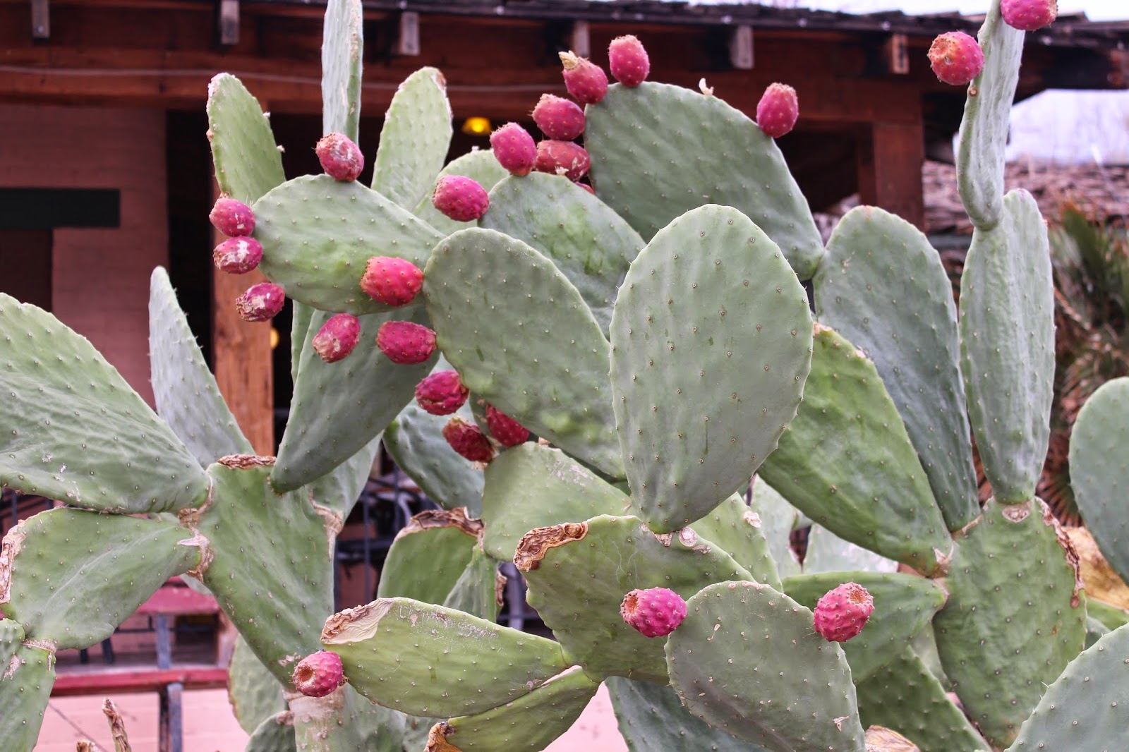
Furnace Creek Inn's gardens, greenery and streams led us to a wonderful spring-fed swimming pool!


The very next day, as the skies cleared, we ventured again to Panamint Springs, stopping at the same restaurant (above) prior to hitting up Darwin Falls - the only place in Death Valley where you can actually find a true waterfall. On the way, we appreciate the desert shrubbery

Hello buddy... these kit wolves roam around the lower elevations of Death Valley .. we saw plenty of them in Scotty's Castle grounds as well as near the Ranch of Furnace Creek. Their cousins, the Coyote are also plentiful in DV. We were hoping but never did spot the bighorn sheeps which make their home in the mtns


The hike to Darwin Falls - lots of mossy rocks and more concentration of green granites with bluish veins adding more texture to the surrounding vegetation (mesquites, joshua trees, pinyon pines, california junipers, cottonwood & desert willows)...me thinks all would be even prettier in spring / summer


Mines in this district are no longer active but once upon a time there used be substantial mining operations by Anaconda Company extracting lead, silver, zinc, tungsten and copper.
Well...we did not expect to find such lush and verdant valley in the midst of this vast & harsh desert landscape..yet here it is. This tiny oasis actually contains a waterfall from an underground spring and it flows year-round.

On to Vegas to Refresh & Clean-up (unfortunately its the casinos cleaning up)


At Caesars Nobu ( owned by Robert De Niro )

Opening day of White Castle -- amazing lineup all the way around the back of Walgreens parking lot for several days! Wondering ... what do they put in their burgers ??


We topped off our Vegas experience with a great concert from Santana at House of Blues in Mandalay